
Image:Bavaria ts.png
From the Simple English Wikipedia, the free encyclopedia that anyone can change
No higher resolution available.
Bavaria_ts.png (237 × 245 pixel, file size: 15 KB, MIME type: image/png)
The description on its file description page on the shared repository is shown below.
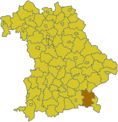
Karte Bayerns mit dem Landkreis Traunstein
Karten sind selbsterstellt, z.T. durch triviales Ausmalen der Vorlagen aus [1]. Daher allesamt GFDL.

File history
Click on a date/time to view the file as it appeared at that time.
| Date/Time | Dimensions | User | Comment | |
|---|---|---|---|---|
| current | 12:20, 28 February 2006 | 237×245 (15 KB) | Tsca.bot | ( Karte Bayerns mit dem Landkreis Traunstein Karten sind selbsterstellt, z.T. durch triviales Ausmalen der Vorlagen aus [http://en.wikipedia.org/wiki/Wikipedia:WikiProject_German_districts/Maptemplates]. Daher allesamt GFDL. {{GFDL}} [[Category:Maps of ) |
Links
The following page links to this file:


